
Take a look at a modern Map of the Bathgate Hills in West Lothian that lie between Bathgate and Linlithgow. Just to the North East of the village of Torphichen, you will see an area of land marked “The Loch”. Yet there’s no water there.Just fields. A Vanishing Loch.
However, there is a reservoir that lies to the immediate South of this area. But if you look at an old map from before the early 19th century, you’ll see a loch. So what happened to this Vanishing Loch?
The Vanishing Loch that reappeared
When we look at Old maps from before the early 1800’s, we can see a distinct mass of water here. Right on this spot, is a pond of water named ‘Loch Cote’.Whats more, on the banks, we can see a Castle marked clearly as Lochcote Castle’ situated just on the South Western bank of the Loch. Yet, strangely enough, there is absolutely no sign of the modern day Lochcote reservoir which we can see on present day maps. So, what happened here then? How could a whole entire Loch just simply move about quarter of a mile south?
The Draining of Loch Cote
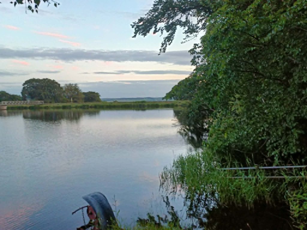
When a man named Peter Wishart bought the lands of Loch Cote castle in 1820, he didn’t see the Loch as an asset. But as a hinderance. A ‘Useless Appendage’ to his land is what he is said to have described the castle ruins and the loch. Back then, especially during this time of ‘Enlightenment’ and ‘Great Improvement’, land owners had little value for scenery or Archaeology.
Things such as those we now recognise as ancient settlements or Standing stones, were often viewed by farmers and landowners a obstacles. Or in many cases, Obstacles that can be utilised for building. So, sadly throughout this period, so much of what existed beforehand would have been demolished and repurposed. In order to build the modern rural landscape we know today. These big puddles were no more than a hinderance to profit to them. Land that could have crops growing upon it.
So, One April day in 1820, Peter Wishart drained the Loch by digging a series of long drainage ditches running across the Loch’s width from North to South. He also dug down and widened the grounds existing subterranean waterways allowing the water to drain off much quicker. This subsequently drained the loch and pretty soon, he was able to plant the area with crops.Thus maximising the profits from the land.
Below the Vanishing Loch
This was quite a large scale operation for Its time. But there was plenty of this going on around this time of the ‘Great Improvement’ and agricultural revolution. Land holders all over lowland Scotland were giving their lands a complete overhaul, thus changing the whole agricultural method and way of life as well as the mass replacement of people that entailed this with the Lowland Clearances.
But when Wishart had drained this mass of water that was around 40 acres, they made a discovery. A Discovery that Indicated previous population of the area dating right back to the Iron Age. Right in the middle of the drained loch, projecting from Its muddy bottom were a series of Stakes in a circular setting. Each driven deep Into the ground. Strong and Sturdy to support the structure that sat upon it.
Iron Age Habitation
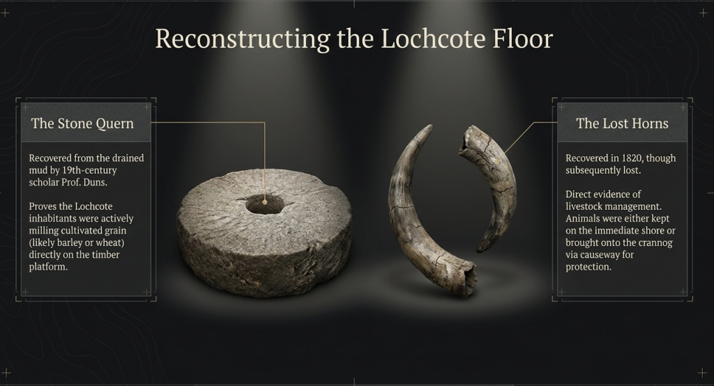
This was the remains of an old Iron Age Crannog dating back to around 2500 BC. A Sure Indication of Iron Age habitation in the area. Also, on the floor of the vanishing loch, other Bronze and Iron age artefacts were recovered. A stone quern was found, Indicating the presence of Industry amongst these prehistoric settlers. Evidence of a thriving Industrial culture that milled its own flour and grain.
An Ancient Horn was also found on the loch bed, indicating the presence of Livestock and the presence of herding livestock amongst these people and their culture. These ancient historic artefacts are kept in the national museum of Scotland. But unfortunately any traces of the remnants of the Iron Age Crannog are long gone.
Sadly for the CRannog though, back in these days they had absolutely No Value for Historical artifacts getting in the way of Profit. So, it was quickly demolished. But at least these findings were indeed charted. So, at least we know about its previous existence. But It just goes to show how much ancient archaeology we could have learned so much from has just been destroyed over the years and lost forever. Sadly too, this also goes on far too much today still.
Residences of Lochcote
With this mass of water being situated here amongst the hills, the site has been a residential site for a long time. The area around Loch Cote would have also at One time been the main route to Linlithgow and Bo’ness from Bathgate and Barbauchlaw to the South West and even Lanark further to the South. It sat right in the valley beneath Bowden Hill on the North. Passing onwards by cockleroy before sloping down from the hills towards the waters of the Forth.
Crannog
So, as we mentioned previously, the remains of an old Iron age Crannog were found situated right in the middle of the vanishing Loch. This is believed to be just One of Several Crannogs that were situated upon Lochcote, as well as similar structures upon the nearby River Avon that were also found around the same time.
These Water dwelling structures were circular and sat upon stilts that would have been driven deep into the Loch floor or River bed, supporting it. They would have doubtlessly been situated as defensive structures. Thus keeping its residents safe from raiders.
Castle
It’s not entirely sure when exactly the castle was built, why and by whom? But It Once stood as a very prominent Castle on the old maps from the 18th century and before. It is thought to have been built around the 16th or early 17th century and was a square shaped tower keep with Four Turreted towers, One in each corner. In 1807, It was described as being of “Formidable doom and splendour”.
Situated upon the edge of Loch Cote, Lochcote castle would have been a strong defensive residence. But by the late 18th century, landowners had shifted their priorities from defense to profitable Industry and the castle, being no longer needed. It was mostly demolished and was repurposed. The stone was used to build a newer Mansion house. One that focused on comfort and grandeur over strategic defense.
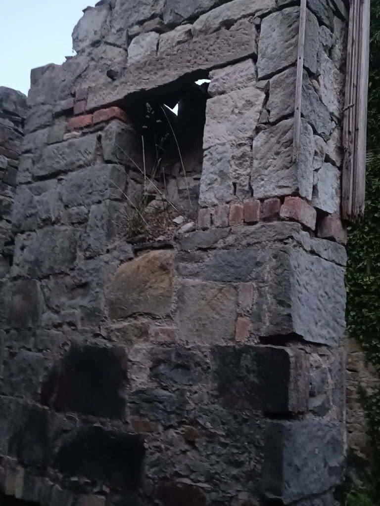
However, although the vast majority of the castle has long since been wiped out of existence, One part still remains. Wishart had One of the tall corner lookout towers repurposed into a Dovecote. By sheltering pigeons, this provided the residents of the mansion next door with a source of fresh meat. It was due to this adaptation and repurposing that we are still able to see these last surviving remnants of Lochcote castle today.
Mansion
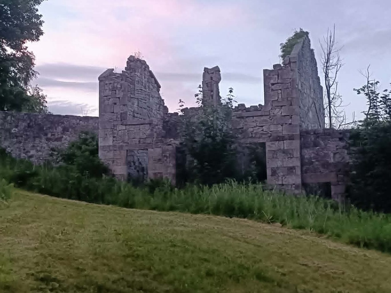
After expensive litigation and a lengthy legal battle over a well, the big house was left Impoverished and gradually fell into disrepair. The Grand Mansion was eventually demolished on safety grounds in the 1970s. But Its ruins still stand here today. A Tall Sturdy big house with big tall walled garden enclosure to the back of it.
The crumbing walls of the Old mansion look really pretty today as they blend into the surrounding woodland with the help of its Ivy carpeted walls that have evolved to use the original 19th century wooden inner lining of the stone walls as a trellis to climb up. Unfortunately, since this lies on Private Property, you cant access the walled garden which is closed off by a heavy bolted door. But you can see over the top of the door, through a gap which shows that its very overgrown Inside.
House
The lands that contain these ruins and the drained Loch are today private land and another big house has been built upon the site. Just up the hill about 200 yards to the North of the Old house and about the same distance to the West of the Original Castle site by the edge of the Loch where the Tower still stands today. This new house actually looks a lot older than it is, and is built of Stone and made to look like an Old mansion house. But, It was only built a few decades ago.
The Loch that Reappeared
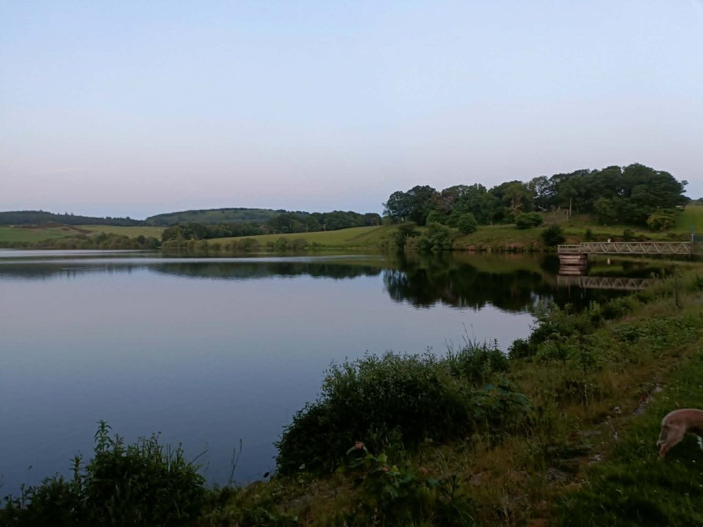
So, what about the big pool of water that’s there today and can be seen on modern day maps? It lies about 200 yards to the South of the original vanishing Loch. But If this body of water does not appear on the Old maps from the time of the castle and original Loch, then where did it spring from?
This new Aquatic addition to the Bathgate hills was aptly named ‘Lochcote Reservoir’ in Tribute to Its original predecessor. This modern reservoir was subsequently constructed to the south of the Lochcote mansion to serve as a dedicated water supply for Bo’ness.
To create this new reservoir, the Brunton Burn—a stream that originates on the south side of Cockleroy Hill—was dammed, forming a nearly rectangular body of water covering 17 hectares. Historically, the reservoir was owned by the Bo’ness town council, which employed a local waterman to manage the site. If water levels at Lochcote ever ran too low, the supply was supplemented by drawing water from a subsidiary reservoir at nearby Bowden. In more recent times, the reservoir was operated by Scottish Water